|
Tunica Hills Wildlife Management Area
|
|
|
||||||
|
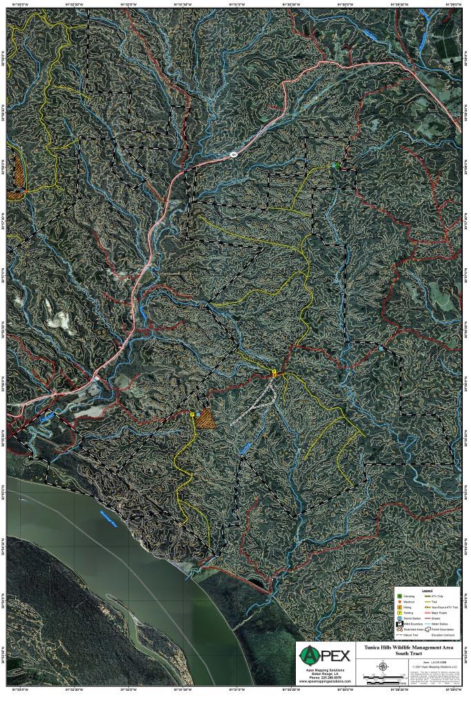
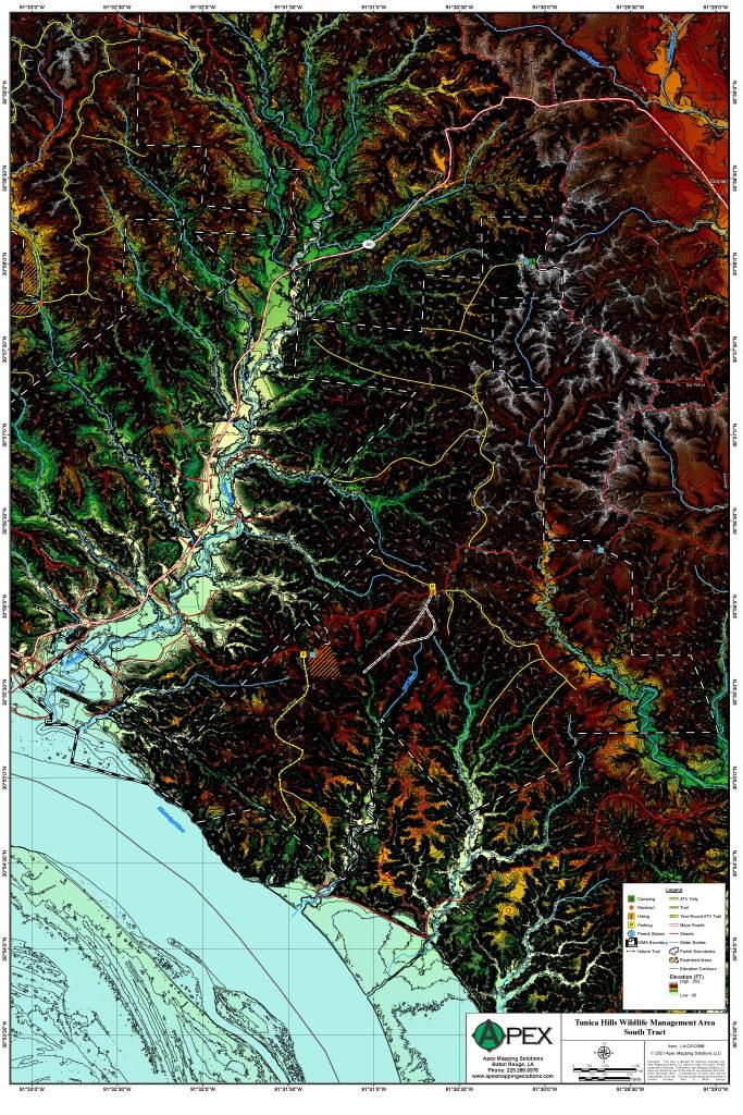
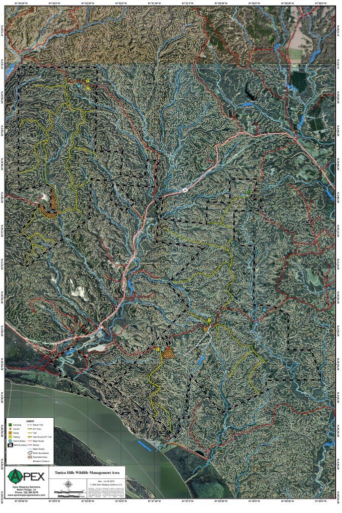
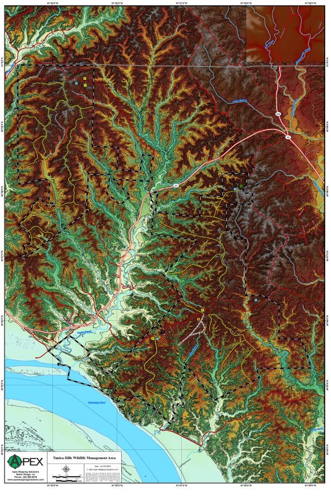
Tunica Hills Wildlife Management Area is composed of two separate tracts lying northwest of St. Francisville
in West Feliciana Parish. The Angola Tract (2,345 acres) lies immediately adjacent to the Louisiana State Penitentiary. This
tract is located 14.3 miles west on LA Hwy 66 from LA Hwy 61, the Farrar-Davis Road turns off to the right, and a check station
is located 3 miles to the north. The South Tract (3,560 acres) may be accessed by driving 17.3 miles west on Hwy 66 from Hwy
61. A small road, the Old Tunica Trace will turn off to the left, run approximately a mile up in the hills and bisect the
management area. The Old Tunica Trace is a portion of the scenic Natchez Trace System and has been used for travel since colonial
times.
Click Here To Read More |
||||||||
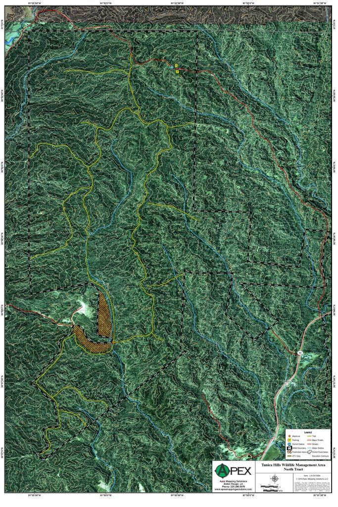
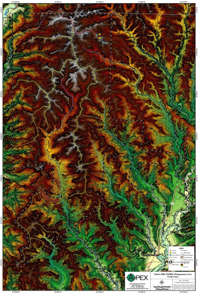
Tunica Hills Wildlife Management Area
- North Tract
|
|
|
||||||
Tunica Hills Wildlife Management Area
- South Tract
|
|
|
||||||