HomeAbout UsOutdoor SeriesMarine SeriesReference SeriesCustom MapsGIS ServicesPricingContact Us

Shawnee National Forest Maps

 
Outdoor_Maps/shawnee001.jpg
Shawnee National Forest Aerial Map (Large Scale)

Order Shawnee National Forest Map (Large Scale)

Paper Sizes
Media Types
Background

Outdoor_Maps/shawnee_topo001.jpg
Shawnee National Forest Topo Map (Large Scale)


Plant life is extremely diverse and ranges from sun-loving species to those that grow in dense shade. Tree cover dominates the publicly owned acreage, and is a significant component on privately owned lands. Oak-hickory is the predominant timber type, however, many other commercially important timber species also occupy significant acreages. More than 500 wildlife species can be found within the Forest, including 48 mammals, 237 birds, 52 reptiles, 57 amphibians, and 109 species of fish. There are seven federally-listed threatened and endangered species inhabiting the Forest, as well as 33 species which are considered regionally sensitive, and 114 Forest-listed species. 

To Read More Click Here...

Shawnee National Forest - Hidden Springs Ranger District Maps

 
Outdoor_Maps/shawnee_hidden_springs001.jpg
Shawnee National Forest - Hidden Springs Ranger District Aerial Map

Order Hidden Springs Ranger District Map

Paper Sizes
Media Types
Background

Outdoor_Maps/shawnee_hidden_springs_topo001.jpg
Shawnee National Forest - Hidden Springs Ranger District Topo Map


Outdoor_Maps/shawnee_johnson001.jpg
Shawnee National Forest - Johnson County Aerial Map

Order Johnson County Map

Paper Sizes
Media Types
Background

Outdoor_Maps/shawnee_johnson_topo001.jpg
Shawnee National Forest - Johnson County Topo Map


Outdoor_Maps/shawnee_pope_north001.jpg
Shawnee National Forest Pope County (North) Aerial Map

Order Pope County (North) Map

Paper Sizes
Media Types
Background

Outdoor_Maps/shawnee_pope_north_topo_001.jpg
Shawnee National Forest Pope County (North) Topo Map


Outdoor_Maps/shawnee_pope_south001.jpg
Shawnee National Forest Pope County (South) Aerial Map

Order Pope County (South) Map

Paper Sizes
Media Types
Background

Outdoor_Maps/shawnee_pope_south_topo_001.jpg
Shawnee National Forest Pope County (South) Topo Map


Outdoor_Maps/crab_orchard_001.jpg
Shawnee National Forest - Hardin County Aerial Map

Order Hardin County Map

Paper Sizes
Media Types
Background

Outdoor_Maps/crab_orchard_topo001.jpg
Shawnee National Forest - Hardin County Topo Map


Outdoor_Maps/crab_orchard_001.jpg
Shawnee National Forest - Saline County Aerial Map

Order Saline County Map

Paper Sizes
Media Types
Background

Outdoor_Maps/crab_orchard_topo001.jpg
Shawnee National Forest - Saline County Topo Map


Outdoor_Maps/crab_orchard_001.jpg
Shawnee National Forest - Gallatin County Aerial Map

Order Gallatin County Map

Paper Sizes
Media Types
Background

Outdoor_Maps/crab_orchard_topo001.jpg
Shawnee National Forest - Gallatin County Topo Map


Outdoor_Maps/crab_orchard_001.jpg

Order Burden Falls/Bay Creek Wilderness Areas Map

Paper Sizes
Media Types
Background

Outdoor_Maps/crab_orchard_topo001.jpg


Outdoor_Maps/crab_orchard_001.jpg

Order Lusk Creek Wilderness Area Map

Paper Sizes
Media Types
Background

Outdoor_Maps/crab_orchard_topo001.jpg


Outdoor_Maps/crab_orchard_001.jpg

Order Garden of the Gods Area Map

Paper Sizes
Media Types
Background

Outdoor_Maps/crab_orchard_topo001.jpg


Shawnee National Forest - Mississippi Bluffs Ranger District Maps

 
Outdoor_Maps/shawnee_miss_bluff001.jpg
Shawnee National Forest - Mississippi Bluffs Ranger District Aerial Map

Order Mississippi Bluffs Ranger District Map

Paper Sizes
Media Types
Background

Outdoor_Maps/shawnee_miss_bluff_topo001.jpg
Shawnee National Forest - Mississippi Bluffs Ranger District Topo Map


Outdoor_Maps/shawnee_jack_north001.jpg
Shawnee National Forest - Jackson County (North) Aerial Map

Order Jackson County (North) Map

Paper Sizes
Media Types
Background

Outdoor_Maps/shawnee_jack_north_topo001.jpg
Shawnee National Forest - Jackson County (North) Topo Map


Outdoor_Maps/shawnee_jack_south001.jpg
Shawnee National Forest - Jackson County (South) Aerial Map

Order Jackson County (South) Map

Paper Sizes
Media Types
Background

Outdoor_Maps/shawnee_jack_south_topo001.jpg
Shawnee National Forest - Jackson County (South) Topo Map


Outdoor_Maps/shawnee_union_north001.jpg
Shawnee National Forest - Union County (North) Aerial Map

Order Union County (North) Map

Paper Sizes
Media Types
Background

Outdoor_Maps/shawnee_union_north_topo001.jpg
Shawnee National Forest - Union County (North) Topo Map


Outdoor_Maps/shawnee_union_south001.jpg
Shawnee National Forest - Union County (South) Aerial Map

Order Union County (South) Map

Paper Sizes
Media Types
Background

Outdoor_Maps/shawnee_union_south_topo001.jpg
Shawnee National Forest - Union County (South) Topo Map


Outdoor_Maps/shawnee_union_east001.jpg
Shawnee National Forest - Union County (East) Aerial Map

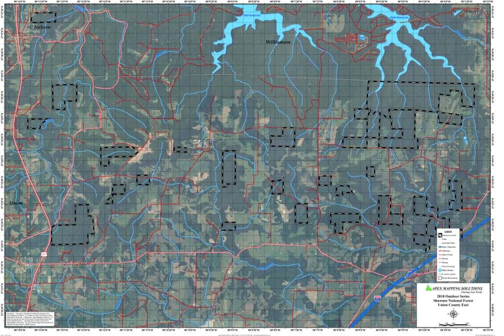
Order Union County (East) Map

Paper Sizes
Media Types
Background

Outdoor_Maps/shawnee_union_east_topo001.jpg
Shawnee National Forest - Union County (East) Topo Map


Outdoor_Maps/shawnee_alex001.jpg
Shawnee National Forest - Alexander County Aerial Map

Order Alexander County Map

Paper Sizes
Media Types
Background

Outdoor_Maps/shawnee_alex_topo001.jpg
Shawnee National Forest - Alexander County Topo Map


Outdoor_Maps/shawnee_clear_bald001.jpg
Shawnee National Forest - Clear Springs and Bald Knob Wilderness Aerial Map

Order Clear Springs/Bald Knob Wilderness Areas Map

Paper Sizes
Media Types
Background

Outdoor_Maps/shawnee_clear_bald_topo001.jpg
Shawnee National Forest - Clear Springs and Bald Knob Wilderness Topo Map


Return to Illinois Outdoor Maps