|
Black Bayou Lake National Wildlife Refuge
|
|
|
||||||
|
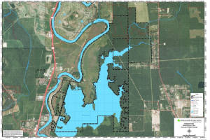
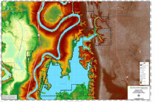
Black Bayou Lake National Wildlife Refuge was established in 1997 through a unique partnership with the
city of Monroe, Louisiana. The 2,000 acre scenic lake is owned by the city and serves as its secondary water source. The U.S.
Fish and Wildlife Service has a free ninety-nine year management lease on the lake. The Service purchased 2,200 acres of land
surrounding the lake, which expanded the refuge to 4,200 acres and protected most of the lake's watershed. The beautiful
natural lake is studded with picturesque cypress and tupelo trees, and surrounded by swamps that graduate into bottomland
hardwoods and then into upland mixed pine/hardwoods. The refuge supports an excellent fisheries resource and provides valuable
habitat for migratory waterfowl, neotropical migratory songbirds, and many resident wildlife species.
Click Here To Read More... |
||||||||