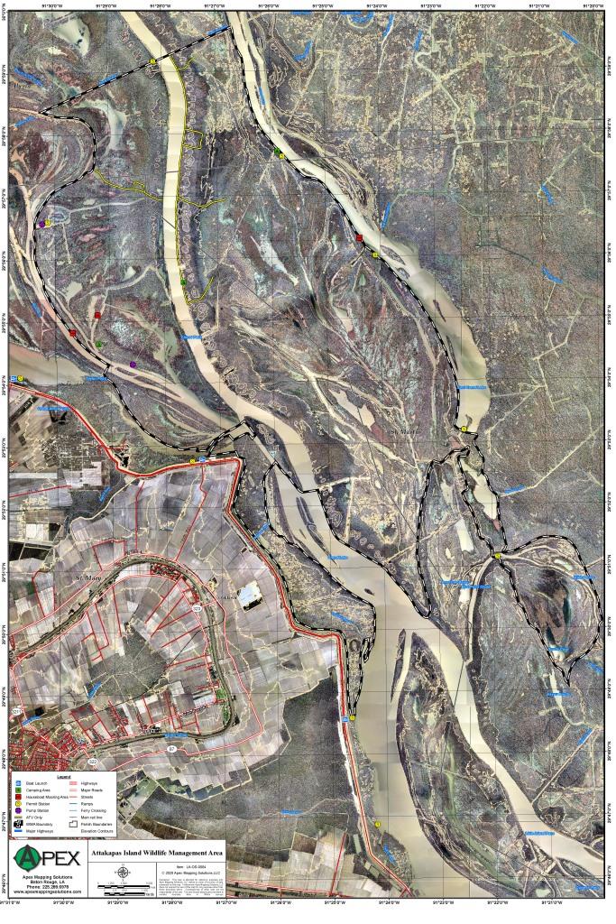
Attakapas Wildlife Management Area, located in upper St. Mary Parish and in parts of lower St. Martin
and Iberia Parishes, was acquired in 1976. The center of the area is situated about 20 miles NW of Morgan City and 10 miles
NE of Franklin. The U.S. Army Corps of Engineers owns a small tract of land that is also managed by La. Department of Wildlife
and Fisheries. Access to the 27,962 acre tract is by boat only, with major public launches available: (1) Millet Point, at
St. Mary Parish Road 123, off of Hwy 87, (2) NNE of Charenton Of Hwy 326, (3) above Morgan City on Hwy 70, (4) off Hwy. 75
at Bayou Pigeon landing in Iberville Parish. Click Here To Read More... |