|
Acadiana Conservation Corridor Wildlife
Management Area
|
Order Maps
|
|
||||||
|
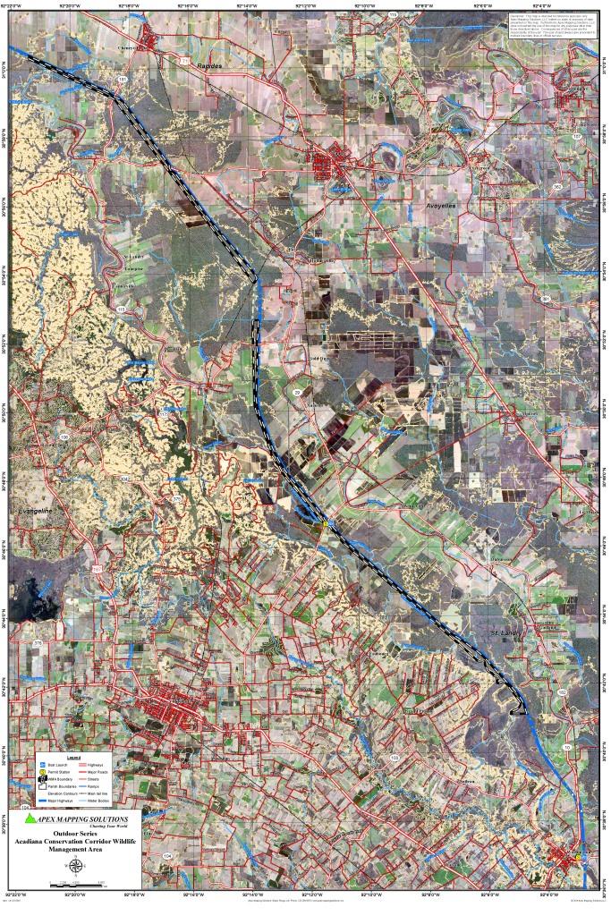
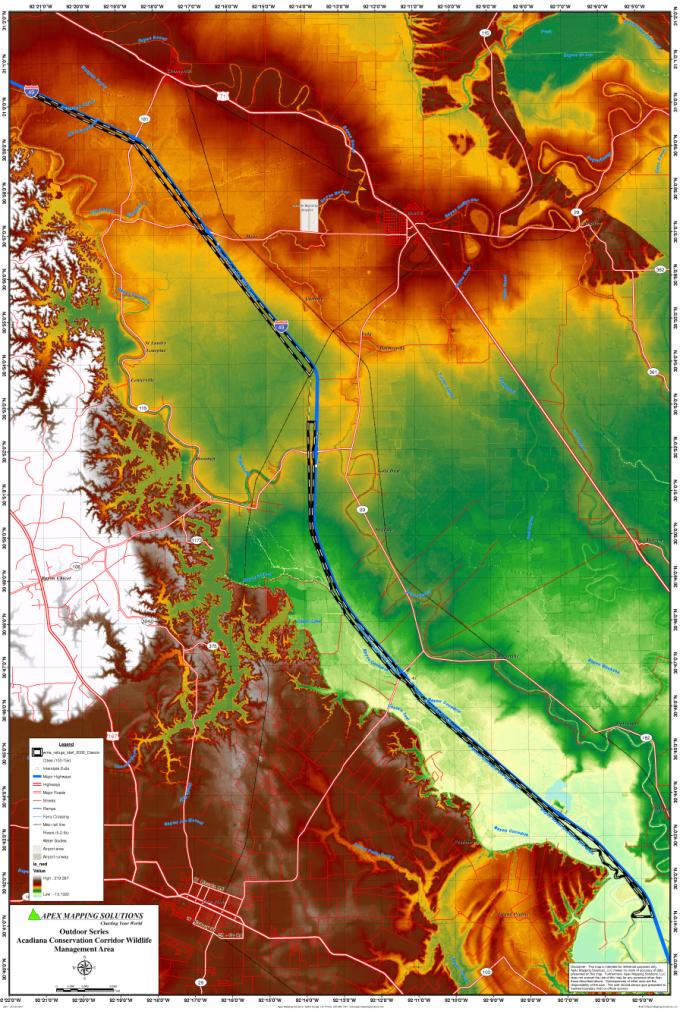
The Acadiana Conservation Corridor WMA is a tract of land situated in the parishes of St. Landry, Evangeline,
Avoyelles, and Rapides, owned by the Louisiana Department of Wildlife and Fisheries. This scenic easement area lying between
the I-49 right-of-way westward to the Bayou Boeuf-Cocodrie Diversion Canal, begins just north of the community of Washington,
La. in St. Landry Parish and extends northward through Evangeline Parish, Avoyelles Parish, and the southern portion of Rapides
Parish. The entire length of this area is approximately 26 miles and comprises approximately 2285 acres.
Click Here To Read More... |
||||||||