|
Sabine Island Wildlife Management Area
|
|
|
||||||
|
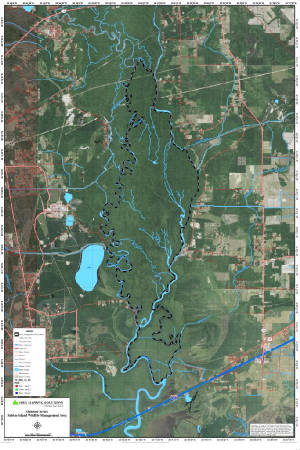
Sabine Island Wildlife Management Area is located in west-central Calcasieu Parish between Vinton and
Starks. Access to the area can be attained by taking Louisiana Highway 109 north from Vinton or south from Starks and then
taking the Nibblets Bluff Park road west from Louisiana Highway 109. The area is completely surrounded by water and access
to the area can only be gained by boat.
To Read More Click Here... |
||||||||