|
Indian Bayou
|
|
|
||||||
|
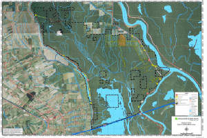
Indian Bayou, located in the Morganza Floodway system of the Atchafalaya Basin, is situated in St. Landry
and St. Martin Parishes, between the Atchafalaya River and the West Protection Guide Levee. The area is classified as bottomland
hardwoods with four dominant tree species associations: (1) cottonwood-sycamore, (2) oak-gum-hackberry-ash, (3) willow-cypress-ash,
(4) overcup oak-bitter pecan. Midstory species encompass seedlings of dominant species along with boxelder, maple, red mulberry,
and rough-leaf dogwood. Ground cover is sparse, in areas, due to shading out and prolonged inundation.
Click Here To Read More... |
||||||||